File list
From Carrick-Overbrook Historical Society
This special page shows all uploaded files.
First page |
Previous page |
Next page |
Last page |
| Date | Name | Thumbnail | Size | User | Description | Versions |
|---|---|---|---|---|---|---|
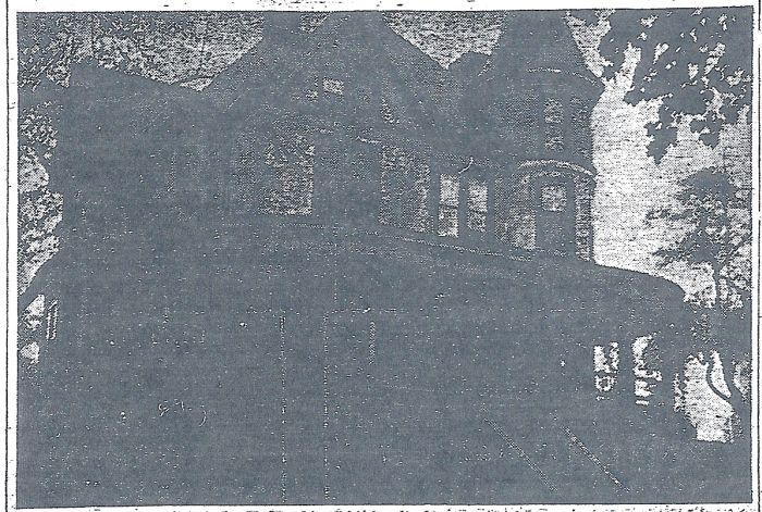
| 15:15, 6 July 2008 | Impton Rear.jpg (file) |  |
55 KB | Jrudiak | Currently the only photo of John M. Phillips' Mansion "Impton" from the rear. Photo courtesy of Julie Tomasic. | 1 |
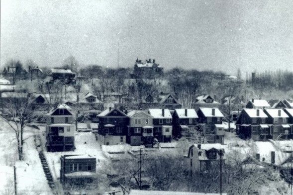
| 15:13, 6 July 2008 | Impton.jpg (file) |  |
110 KB | Jrudiak | Currently the only photo of "Impton" from the front. Current site of St. Pius Church. | 1 |
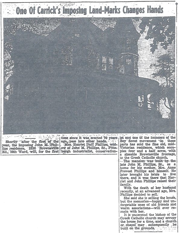
| 15:12, 6 July 2008 | John M. Phillips Mansion Impton article.jpg (file) |  |
129 KB | Jrudiak | Article and photo about John M. Phillips' Mansion "Impton" just before being demolished to make way for St. Pius Church. | 1 |
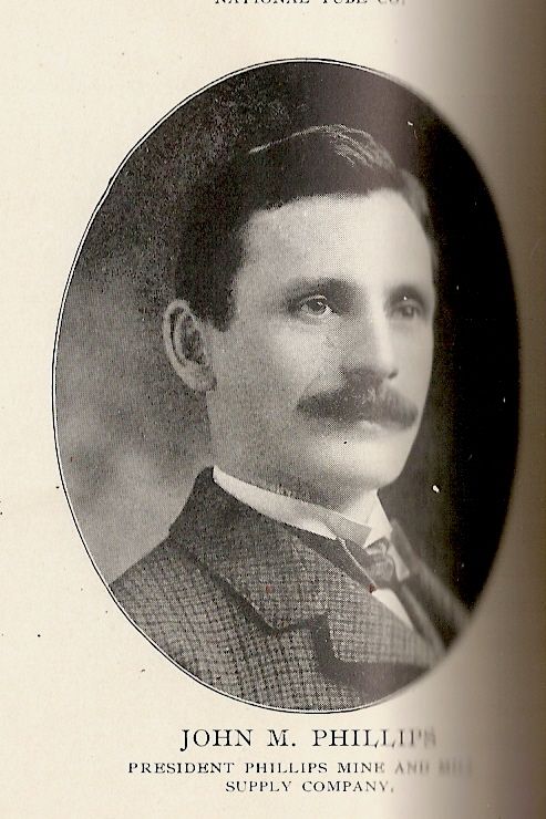
| 15:10, 6 July 2008 | Young John M. Phillips.jpg (file) |  |
70 KB | Jrudiak | John M. Phillips in his younger years. Photo courtesy of Carol Anthony. | 1 |
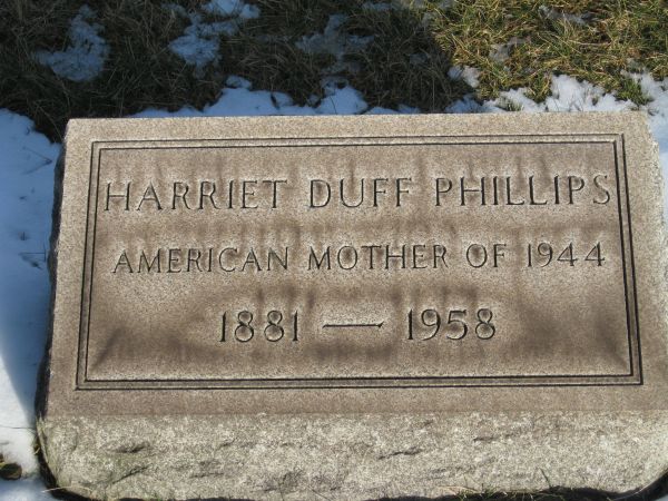
| 14:59, 6 July 2008 | Headstone Harriet Duff Phillips.jpg (file) |  |
83 KB | Jrudiak | This is the headstone of Harriet Duff Phillips buried in Southside Cemetery in Carrick, PA | 1 |
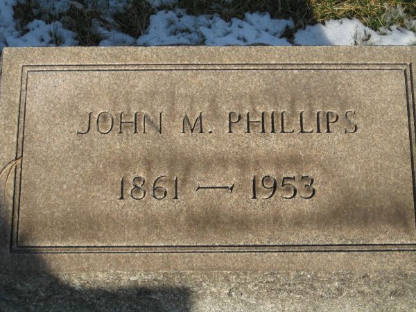
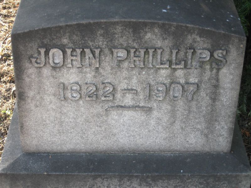
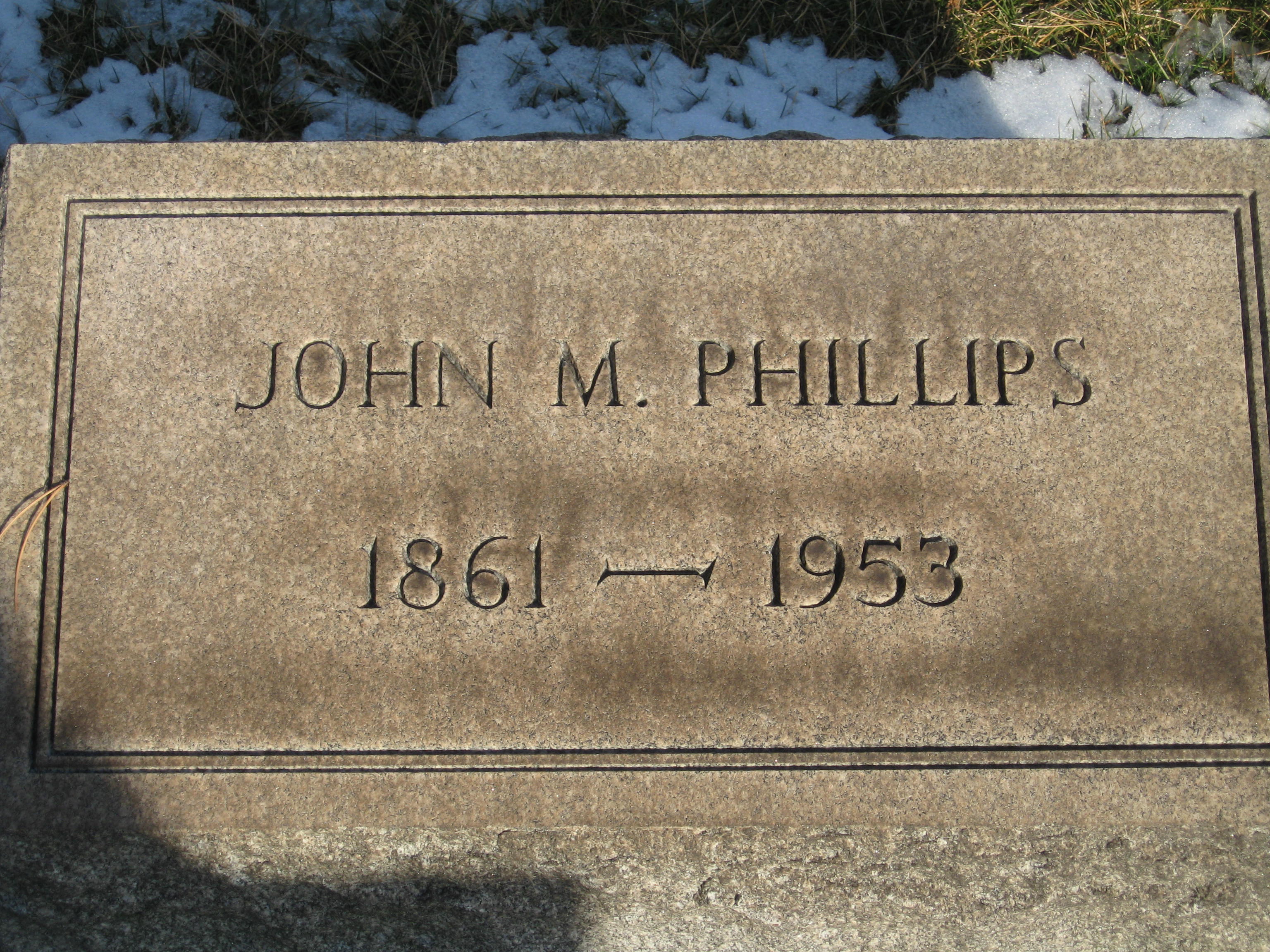
| 14:58, 6 July 2008 | John M. Phillips Headstone.jpg (file) |  |
79 KB | Jrudiak | This is the head stone of John M. Phillips buried in Southside Cemetery in Carrick, PA | 1 |
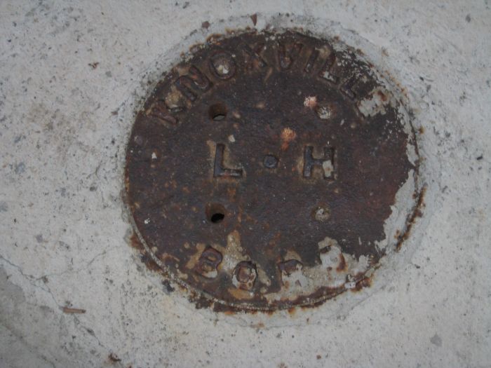
| 09:24, 6 July 2008 | Knoxville Boro LH Madeline at Brownsville resized.jpg (file) |  |
66 KB | Jrudiak | This is a variation of the Carrick LH utility covers. This one says Knoxville Boro LH and is found at the corner of Madeline and Brownsville Road. Was it borrowed from Knoxville Borough? | 1 |
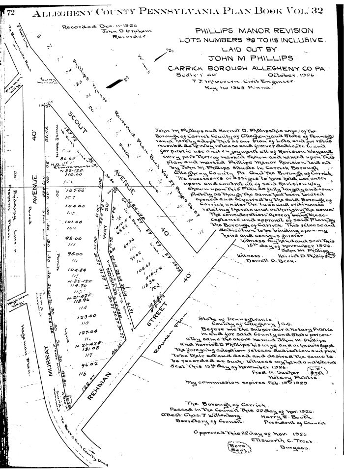
| 09:21, 6 July 2008 | Phillips Manor Revision 1926 resized.jpg (file) |  |
169 KB | Jrudiak | This a revision to the Phillips Manor plan of lots creating Revision Way between Scout Avenue and Rehman Street | 1 |
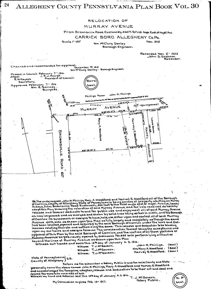
| 09:18, 6 July 2008 | Relocation of Murray Ave 1918 resized.jpg (file) |  |
127 KB | Jrudiak | This is a plan for the relocation of Murray Avenue (now Madeline) at Brownsville Road to make a larger lot for the Union Baptist Church. | 1 |
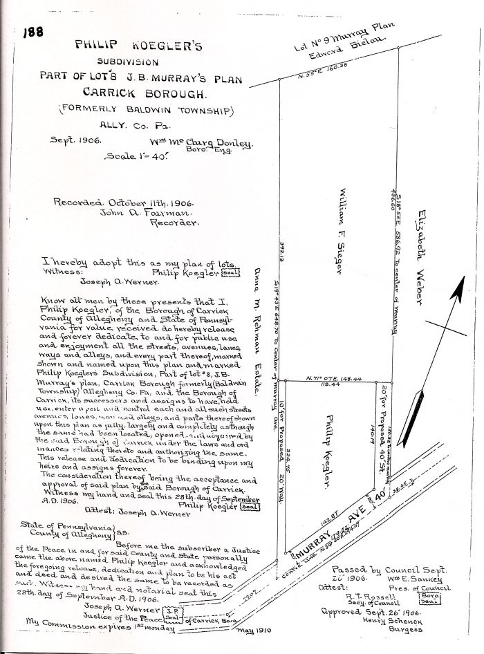
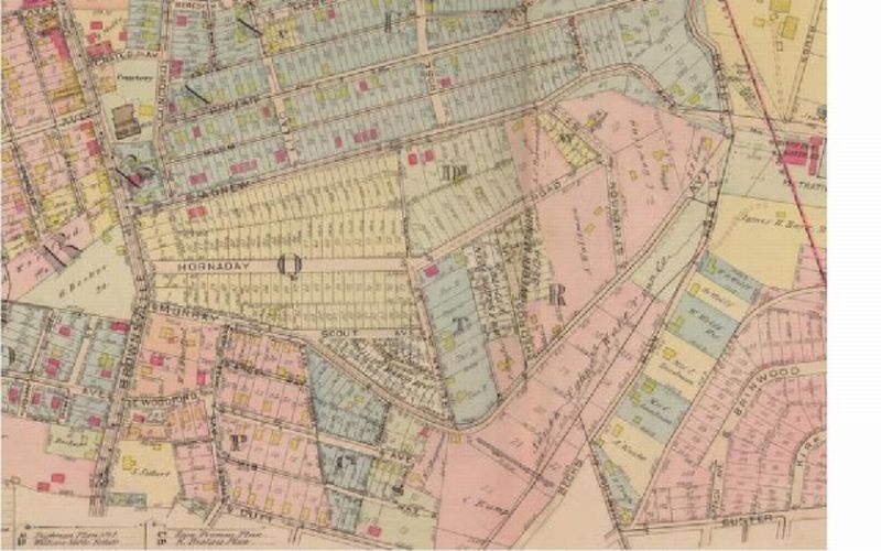
| 09:17, 6 July 2008 | Koegler Plan 1906 resized.jpg (file) |  |
135 KB | Jrudiak | This is a lot plan from Rehman to Redrose on Hornaday Road | 1 |
| 09:14, 6 July 2008 | John Phillips headstone resized.jpg (file) |  |
105 KB | Jrudiak | This is the headstone at Southside Cemetary of John Phillips | 1 |
| 09:12, 6 July 2008 | Hornaday plate plan resized.jpg (file) |  |
82 KB | Jrudiak | This is a plate plan from Historic Pittsburgh Maps | 1 |
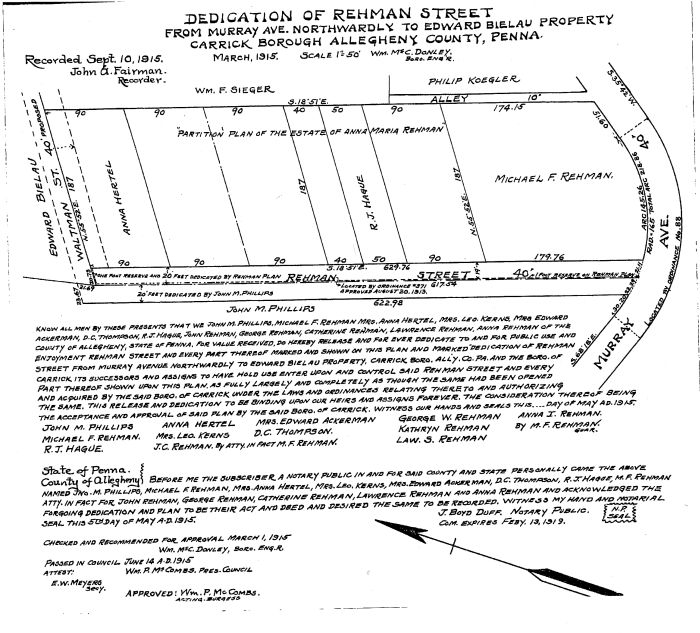
| 09:11, 6 July 2008 | Dedication of Rehman St 1915 resized.jpg (file) |  |
116 KB | Jrudiak | This is the plan of lots for Rehman Street dated 1915 | 1 |
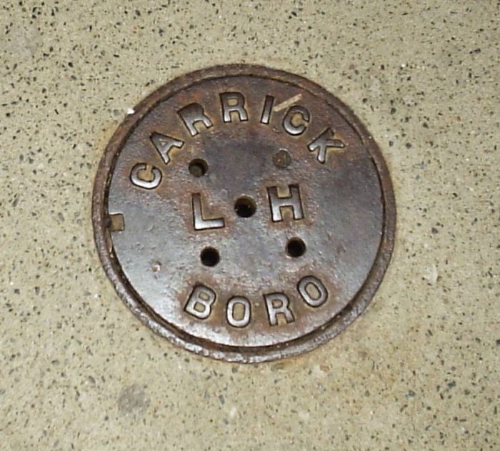
| 09:10, 6 July 2008 | Carrick Borough LH resized.jpg (file) |  |
98 KB | Jrudiak | This is some kind of shut off valve noted Carrick Boro LH found throughout Carrick | 1 |
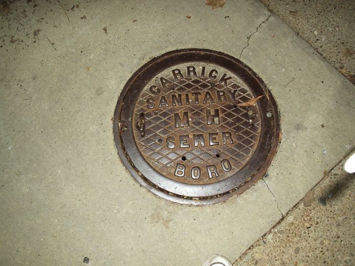
| 09:09, 6 July 2008 | Carrick Boro Sanitary resized.jpg (file) |  |
87 KB | Jrudiak | Carrick Boro Sanitary Manhole cover found throughout Carrick | 1 |
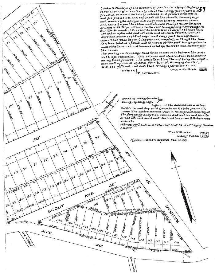
| 09:08, 6 July 2008 | 2nd Half Phillips Manor Plan 1915 resized.jpg (file) |  |
149 KB | Jrudiak | This is the 2nd half of the Phillips Manor Plan of lots dated 1915 | 1 |
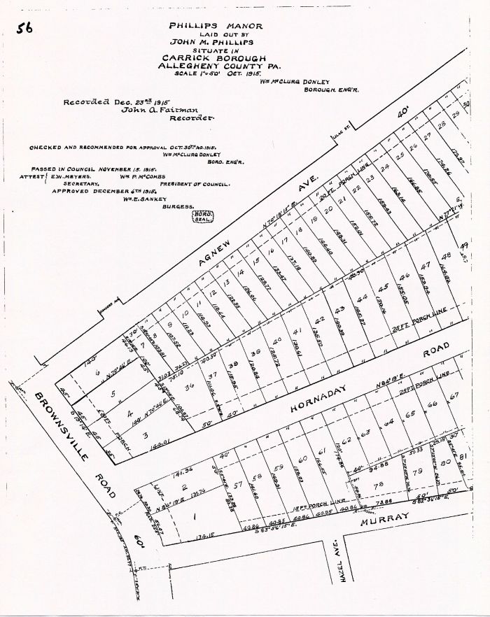
| 09:07, 6 July 2008 | 1st half Phillips Manor plan 1915 resized.jpg (file) |  |
116 KB | Jrudiak | This is the 1st half of the Phillips Manor Plan of Lots dated 1915. | 1 |
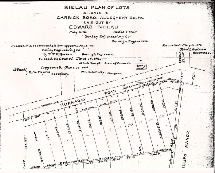
| 09:06, 6 July 2008 | 2nd half Bielau Plan 1916 resized.jpg (file) |  |
122 KB | Jrudiak | This is the 2nd half of the Bielau Plan of Lots | 1 |
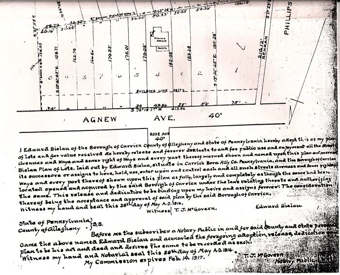
| 09:04, 6 July 2008 | 1st half Beilau Plan 1916 sized.jpg (file) |  |
83 KB | Jrudiak | This is the 1916 Beilau Plan between Agnew Avenue and Hornaday Road from Rehman Street to just below Redrose Avenue. | 1 |
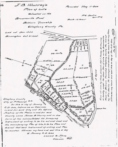
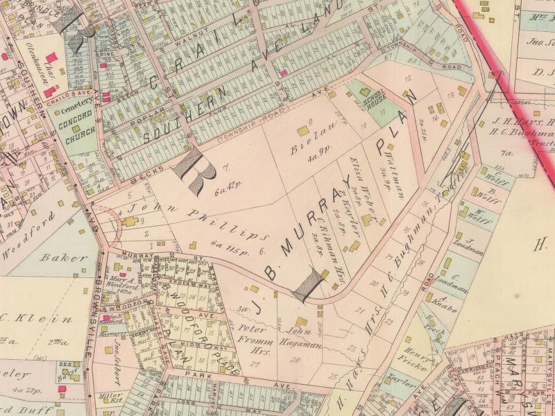
| 09:37, 1 July 2008 | 1859 J.B.jpg (file) |  |
60 KB | Jrudiak | 1859 J. B. Murray Plan of Lots for Hornaday Road from Recorders Office | 1 |
| 09:26, 1 July 2008 | Mansion close up 1905.jpg (file) |  |
73 KB | Jrudiak | Historic Pittsburgh Plate 4 Source Hornaday Mansion Close up 1905 | 1 |
| 09:11, 1 July 2008 | 1916 hornaday.JPG (file) |  |
82 KB | Jrudiak | 1916 Lot and Plot Plan Hornaday Road | 1 |
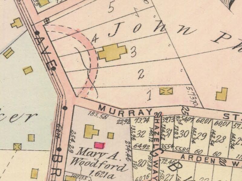
| 08:33, 1 July 2008 | 1905 j.b.murray plan.jpg (file) |  |
114 KB | Jrudiak | 1905 Historic Pittsburgh Plate 4 J. B. Murray Plan (Currently Hornaday Road Vicinity) | 1 |
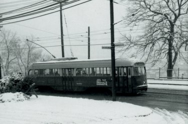
| 08:13, 1 July 2008 | Carrick Street Car.jpg (file) |  |
24 KB | Jrudiak | This is the last run of the Carrick Street Car in 1971. Taken near St. Joseph's Cemetery. | 1 |
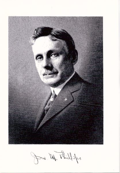
| 14:25, 19 June 2008 | John M. Phillips-1.jpg (file) |  |
53 KB | Jrudiak | 2 | |
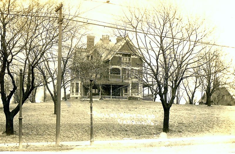
| 14:14, 19 June 2008 | John Phillips Hornaday Homestead-1.jpg (file) |  |
158 KB | Jrudiak | Top of Hornaday Road, John Phillips Homestead, demolished. | 3 |
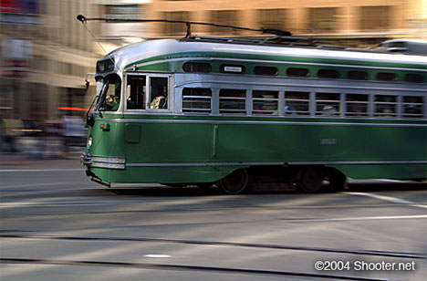
| 10:29, 17 June 2008 | Streetcar-green.jpg (file) |  |
35 KB | Jrudiak | Streetcar from google images. | 1 |
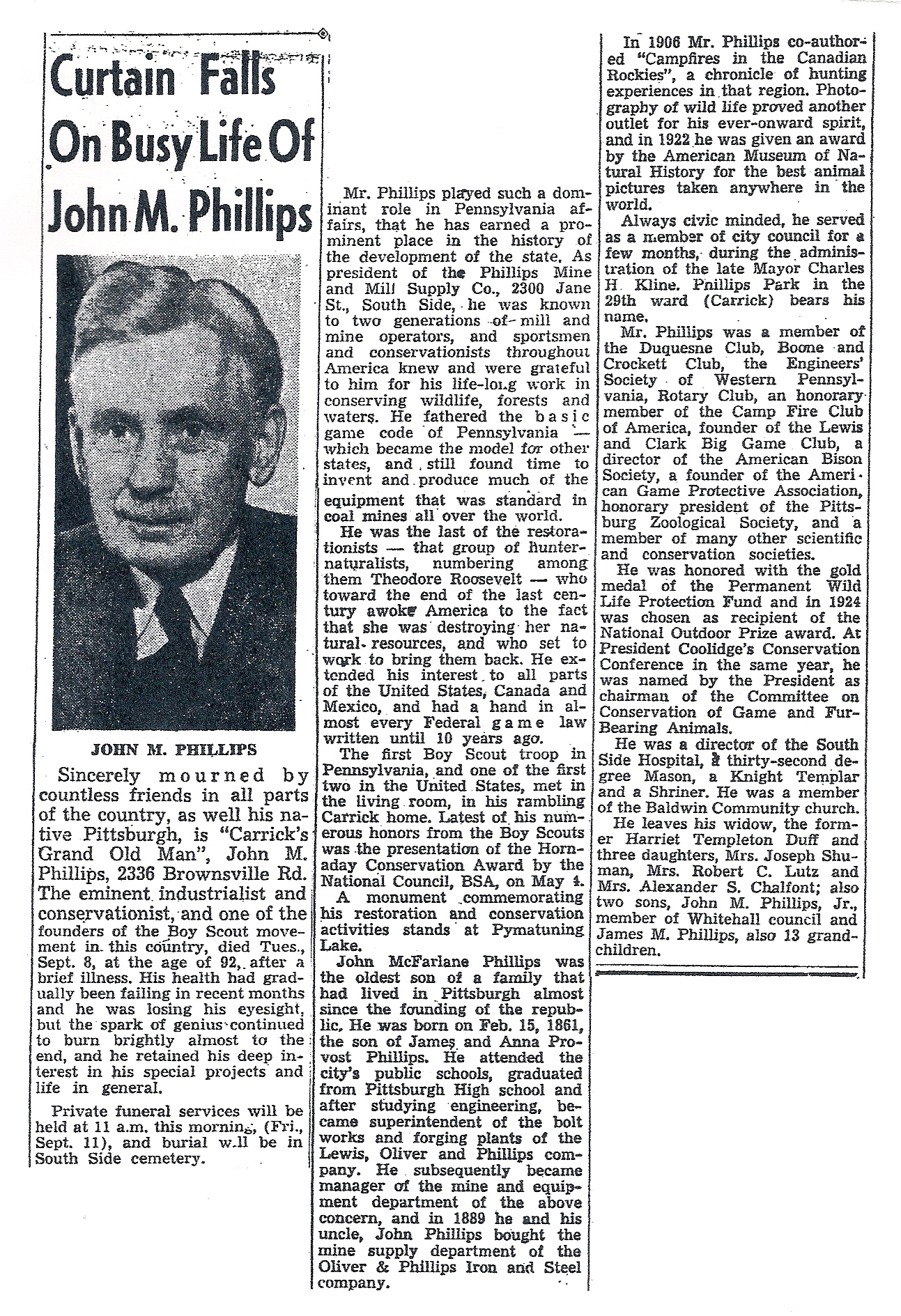
| 14:20, 14 June 2008 | John M. Phillips7-1.jpg (file) |  |
1.61 MB | Jrudiak | John M. Phillips' Obit | 1 |
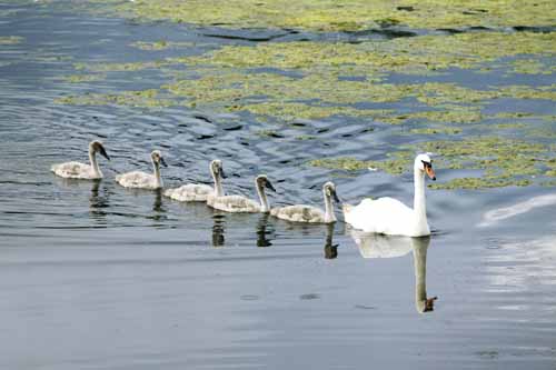
| 13:53, 14 June 2008 | Swans of Carrick-on-Suir.jpg (file) |  |
39 KB | Jrudiak | 1 | |
| 13:42, 14 June 2008 | Carrick-on-suir crest.JPG (file) |  |
17 KB | Jrudiak | This is the town crest of Carrick-on-Suir, Ireland. Carrick-on-Suir (Irish: Carraig na Suire) is a town in County Tipperary, Ireland. As the name – meaning "rock of the suir" – suggests, the town is situated on the River Suir. There are many swans i | 1 |
| 16:23, 10 June 2008 | IMG 0202.jpg (file) |  |
1.31 MB | Jrudiak | John M. Phillips Headstone | 1 |
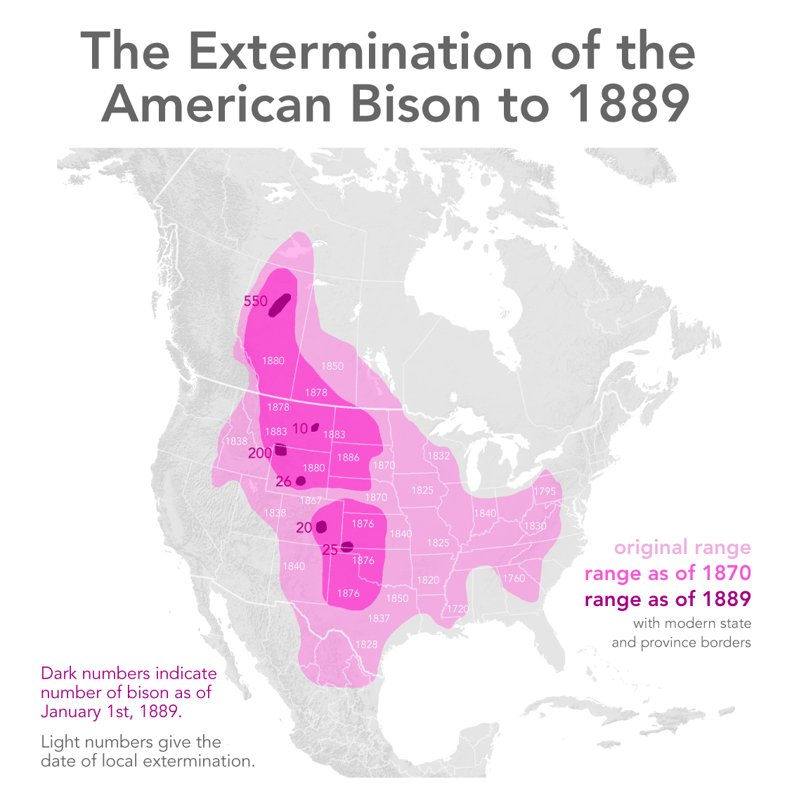
| 14:05, 5 June 2008 | Extermination of bison to 1889.png (file) |  |
436 KB | Jkrynock | 1 | |
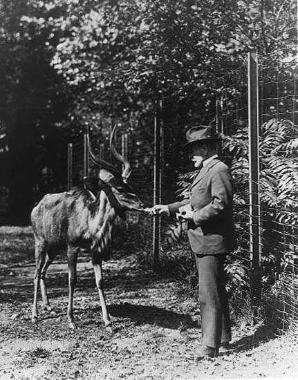
| 14:00, 5 June 2008 | William Hornaday.jpg (file) |  |
54 KB | Jkrynock | Public domain picture of William T. Hornaday | 1 |
First page |
Previous page |
Next page |
Last page |